How To See All Of Fuerteventura in 3 Days
By hiring a car for 3 days you will be able to discover Fuerteventura outside Caleta. Below, are listed 3 suggested routes, 1 for each day.I would suggest a full day trip for each day, to allow stops at the places you visit. First of all, get one of the free maps of the island from your Reception, such as MyGuide.
ROUTE 1 – THE MIDDLE OF THE ISLAND
Leave Caleta on the main road (FV 2) and head north. At the roundabout, signposted Triquivijate, turn left and head inland. It is 15 km to Antigua in the middle of the island.
In Antigua, take the left turn on to the FV 20 and drive for 11 km to Tuineje. You will pass through the villages of Valles de Ortega, Agua de Bueyes and Tiscamanita.
In Tuineje take the right turn to Pajara, on the FV 30, and after 8 km you arrive in the town. Just out of the town centre, a car parking area is signposted on the right. It’s worth parking there (free) because you can visit the local church, have a photo taken next to the colourful bougainvillea flower display and there are toilets there.
A possibility in Pajara is to leave the town on the FV 605 and after 1.5 km take the right turn to Ajuy on the FV 621. After 8 km you arrive at the coastal village of Ajuy, which has some restaurants, a black sand beach and some very large caves, which can be found by taking the cliff path up on the right-hand side of the beach. A 1km walk along the cliff path, then drops down with a stepped access to the caves.
After leaving Ajuy, head back into Pajara.
In Pajara take the FV 30, signposted Betancuria. The road suddenly becomes very winding as you make your way up the mountains. There are some wonderful views as you travel to Vega de Rio Palma and then on to Betancuria, after travelling 15 km. There are some viewing points along this mountain road.
In Betancuria – the former capital of the island – you can park up and visit the church and historic buildings. The Church dates from the 17th Century, and there are the ruins of a Franciscan Convent which was constructed in 1423.
You then leave Betancuria by climbing up a winding road, to another viewpoint where you can look down at Betancuria to the south and to the north of the island. A few metres further along the road you can turn right into the road which leads to the Mirador de Velosa. Park up and go into the visitor centre where you can enjoy panoramic views of the north, middle and east of the island.
After leaving the Mirador, go back down the road and turn left onto the main road, which then descends the mountainside. At the roundabout, turn left and head towards Antigua along the FV 416. In Antigua the old windmill has been restored, and is also home to the Cheese Museum.
From Antigua it is a 16 km drive back to Caleta along the FV 413, and then the FV 2.
ROUTE 2 – THE NORTH OF THE ISLAND
From Caleta it is a 10 km drive to the capital of the island, Puerto del Rosario, along the FV 2. Before reaching the capital you see the village of El Matorral on the left, and then you pass the airport. Next, on the right, is the beach of Playa Blanca.
Before reaching Puerto del Rosario, take the turning on the left (following the Corralejo signs) and this takes you around the bypass (FV-3).
Continue on this road , the FV 1,for about 16 km and you will then reach Parque Holandes. Continue along the FV 1, and then you will arrive at the Parque Natural de Corralejo ( the sand dunes of Corralejo). There are various parking places along this road, and you can wander over the dunes and visit the beaches.
It is then another 10 km into Corralejo.
To find out what’s in Corralejo it’s best to have one of the guide maps, and then you can do your own exploring. If you’re on a day tour, it would be best to allow about 3 hours here.
From Corralejo you can then take the road to Villaverde and then on to La Oliva. After passing through La Oliva, take the right turn to Lajares and on to El Cotillo.
After leaving El Cotillo, head back to La Oliva and follow the directions to Puerto del Rosario. You will pass Tindaya Mountain and village on your right. After that you will have views, on the right, down the middle of the island towards Tefia and Valles de Santa Iñes.
Continue on the main road to Puerto, and you will pass through the village of La Matilla and then the larger village of Tetir. Continue along the road, which then eventually drops down, and you can rejoin the FV -3 Puerto del Rosario bypass. Follow the airport signs, and then head back to Caleta.
ROUTE 3 – THE SOUTH OF THE ISLAND
Leave Caleta on the FV-2 and head south, following the signs to Morro Jable. Just south of Caleta you will arrive at the Atlantico Shopping Centre/Fuerteventura Golf Club roundabout. Go straight on to the next roundabout, which is the access to the Las Salinas Golf Course. Again, go straight on.
After 2 km you will see the small village of Las Salinas on the left. You can visit the Salt Museum there.
Back on the main road you drive past Los Alares, the Antigua turn off, the Los Pozos turn, and follow the Morro Jable signs.
After about 45 minutes you will arrive at La Lajita, the home of Oasis Park Zoo.
From there, you continue south to the resort of Costa Calma.
Then continue on the main road to Morro Jable. On the left you will see the famous Sotavento beaches, to which there is limited access. This is a stretch of new dual carriageway which takes you into the resort of Jandia.
Returning north, you go through Costa Calma, but then take the turn to La Pared. This takes you to the west coast at the narrowest point of the island. The main road then takes you through the mountains to Pajara.
It’s then on to Tuineje, Antigua and back to Caleta de Fuste
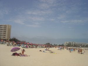
Photos of most of the places to visit on the island can be found in the Photo Gallery